.gif)
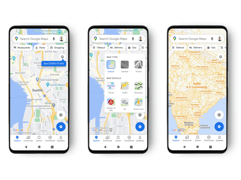
Google introduces COVID-19 Information layer in Maps where it displays 7-day averages of COVID cases in the areas currently being viewed in.
 |
| Tap on Layers then tap on COVID-19 Info |
Maps will show COVID-19 cases per location
 |
| 7-day average COVID-19 cases in the US and in Colombia |
On its official blog page, Google announces that the next update for Maps will include a new layer that displays COVID-19 information on the area currently being viewed in Maps.
Once installed, the new update will add a new COVID-19 Info layer on the Layers tab. Users simply tap on the layers tab on the upper right side of the Maps app and then tap on the COVID-19 Info layer button.
Color coding will be used to easily distinguish the density of cases in an area. Trending case data will be visible at the country level for all 220 countries and territories that Google Maps supports. This includes states, provinces, counties, and City-level data where it is available.
The COVID-19 Information is sourced from authoritative sources that include John Hopkins, the New York Times, and Wikipedia as these sources get data from public health organizations like the World Health Organization, Government Health Ministries, State and local health agencies, and Hospitals.
Google hopes that this new feature will help users get to where they need to be as safe and as efficiently as possible.
The update is set to roll out worldwide on Android and iOS this week.
There is no specific date when it will arrive in the Philippines.
What do you guys think?

.gif)


Post a Comment